Fitzwilliam Explorers – Rimmington Challenge 2008
Your starting instructions for the explorer challenge Saturday 13.9.8
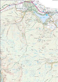
Location
The point on Carr lane, where it becomes Westwood Lane, about half a mile
west south west from the village of Pilley, South of Barnsley, East of Java
etc. in the kingdom of South Yorkshire. (Standing on the pavement, not the
road!)
At that location you will see a bad bend in the road and a track that leads
off past a lodge through Wortley chase towards Wortley. Your future lies
down that track.
The landranger reference is SK328996; the postcode is S75 3BG.
Directions from M1 Junction 36: take the A61 south towards Sheffield. After
¼ mile turn right towards Pilley (Westwood New Road). At the T junction
turn left on New Road and continue for half a mile or so until you enter
Pilley (past Marrens Factory Shop if you know it!). Keep the doors &
windows locked and ignore the zombies. Continue on the same road (now
called Carr Lane) & leave the village heading towards Howbrook, After half
a mile or so you will see the bad left hand bend and the lodge & track.
There will be swirling mist.
How to get a Map showing the start point
There are 2 useful websites:
Streetmap.co.uk type 'SK328996' (the landranger reference) into the
search box and click the 'landranger' button. This will
give you a large-scale map that you can zoom in and out.
If you want to play, find the 'convert/measure' function
and see how useful this website really is for mapreading:
find your own house on the map, click on it & then use
the 'convert/measure' function to find out the
landranger, the grid ref. & even the latitude &
longitude.
Maps.google.co.uk search using the postcode 's753bg' – you will get a
street map with a pointer on it – this is the 'centroid'
for that postcode
For mapping purposes each postcode is assigned a
fictitious point called a centroid & this is why the
postcode search shows you a pointer – usually somewhere
near a group of houses. In fact, there is no such thing
as a postcode 'area' – things with letterboxes e.g.
houses & buildings are simply lumped together and
assigned a postcode for the convenience of the postie.
Ideally a postcode search should bring back a map with
the relevant buildings highlighted, unfortunately
map-resolution limitations mean that we have to put up
with a daft arrow – the 'centroid' – usually somewhere in
the middle of a road. This is why SatNav systems can
sometimes be misleading with postcodes – they 'snap' to
the nearest centroid, (which might be in the next
street), to give you a postcode & this isn't always
correct for the buildings that you might be standing next
to.
Click on the 'satellite' button and you'll get an aerial
photograph (with street names – very useful!) click and
drag the picture to navigate south west out of the
village and you'll find the location – you can even see
the lodge on the corner.
Starting times
Group 1: 12:20 (George, Ian M, Adam B, Ian U)
Group 2: 13:00 (Dale, Andy, Kieran, Ben)
Group 3: 13:40 (Ben W, Nathan T, Nathan L, Adam C)
Kit List
Rucksack
Personal clothing incl. weatherproof gear (note that this is a survival
exercise – keep it to a bare minimum – less weight!)
Bivvy Bag
Sleeping bag & mat
Water bottle
Folding pocket knife (except Nathan)
First aid kit
Torch
Spoon
Mug & Bowl
Pencil & paper
High-energy snacks
Sharp penknife
Compass, Whistle
Warm clothes
Hat/Gloves
Each team will also need one (fully charged, with credit!) mobile
telephone, a map-case, sufficient ponchos to make an overnight shelter
Collection time – end of event.
You should arrange to be collected from Silverwood by midday Sunday
morning. The weakest of you will have been eaten; the survivors might be
very muddy!


 Congratulations to Scouts Paul McAleavy, Luke Hill, Daniel Greenwood, Conner Sweetman


